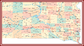
South Dakota is in the north-central part of the United States. Six states share a border with South Dakota: North Dakota on the north, Minnesota and Iowa on the east, Nebraska on the south, and Montana and Wyoming on the west.
There are four distinct land regions in South Dakota: the Drift Prairie, the Dissected Till Plains, the Great Plains, and the Black Hills. The Drift Prairie in the eastern part of the state has lakes and low hills created by ancient glaciers. The southeastern part of the state contains more hills that are cut through by streams and rivers.
The largest landform in South Dakota is the Great Plains, taking up about two-thirds of the state. On the eastern side of the Great Plains, the Missouri River flows from north to south. On the western side of the state, the land rises into buttes, rugged hills, and deep canyons. The Badlands National Park is located in the western part of the Great Plains.
In the far western part of the state, the Black Hills sit between the Belle Fourche and Cheyenne Rivers. These mountains, which also stretch into Wyoming, rise about 3,000 feet (914.4 meters) above the plains. Black Elk Peak has the highest elevation at 7,241 feet (2,207) above sea level. The Black Hills are rich in minerals like gold, silver, and lead, and are heavily mined for these materials. This region is also home to many monuments and tourist attractions like the Mount Rushmore National Memorial and the Crazy Horse Memorial.
South Dakota is home to nine Native American tribes that are part of the Sioux Nation. These groups are subdivided by dialect: the Lakota, Dakota, and Nakota. The Lakota are the largest group, with seven recognized tribal bands. The Nakota are next in population size and primarily live in North and South Dakota and Montana. The smallest group, the Dakota, live mainly in Minnesota or Nebraska.